#NTN #WSN #MIMO #AIML
H.-J. Moon, C.-B. Chae, K.-K. Wong, R. W. Heath Jr.
Early Access, IEEE Communications Magazine, Aug, 2025
Abstract
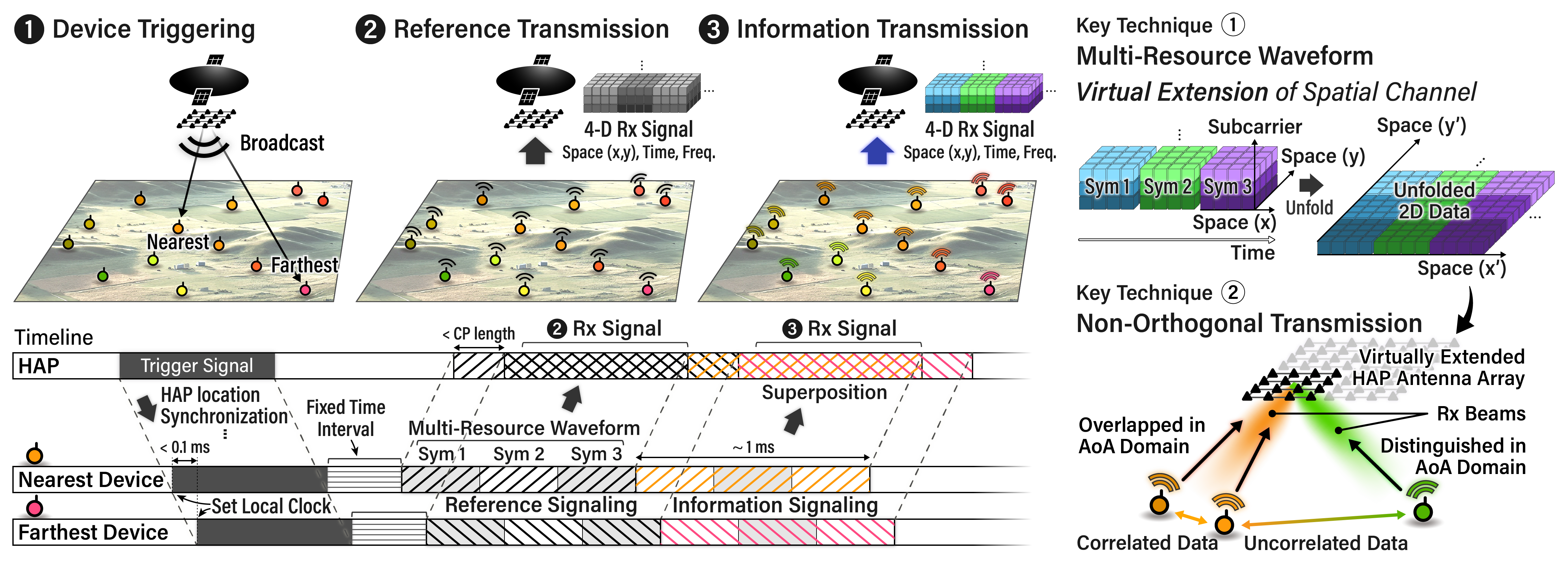
Massive Aerial Processing for X (MAP-X) is an innovative framework for reconstructing spatially correlated ground data, such as environmental or industrial measurements distributed across a wide area, into data maps using a single high altitude pseudo-satellite (HAPS) and a large number of distributed sensors. With subframe-level data reconstruction, MAP-X provides a transformative solution for latency-sensitive IoT applications. This article explores two distinct approaches for AI integration in the post-processing stage of MAP-X. The model-driven pointwise estimation approach enables real-time, adaptive reconstruction through online training, while the end-to-end image reconstruction approach improves reconstruction accuracy through offline training with non-real-time data. Simulation results show that both approaches significantly outperform the conventional inverse discrete Fourier transform (IDFT)-based linear post-processing method. Furthermore, to enable AI-enhanced MAP-X, we propose a ground-HAPS cooperation framework, where terrestrial stations collect, process, and relay training data to the HAPS. With its enhanced capability in reconstructing field data, AI-enhanced MAP-X is applicable to various real-world use cases, including disaster response and network management.

Overview of MAP-X.
© 2021, Ritij Jain | Pudhina Fresh theme for Jekyll.